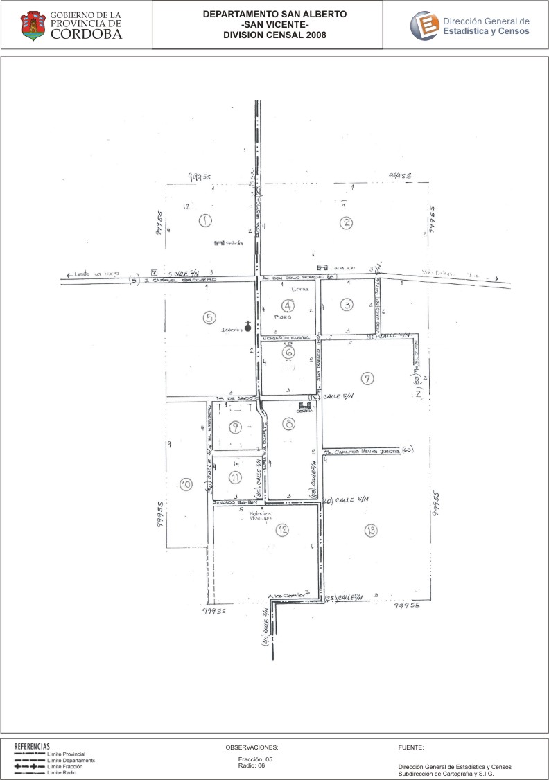
Mapa San Vicente - División Censal - 2008
Aus der Zusammenfassung des Datensatzes
Encuentras aquí los mapas de la cartografía base para tu localidad, pertenecientes a los años 2008 y 2010 en formatos pdf y jpg.
Quelle: Localidad San Vicente - Mapas
Zusätzliche Informationen
| Feld | Wert |
|---|---|
| Zuletzt aktualisiert | 28. Juli 2017 |
| Erstellt | 28. Juli 2017 |
| Format | JPEG |
| Lizenz | Creative Commons Attribution |
| created | vor über 7 Jahren |
| format | JPEG |
| has views | True |
| id | b42eb091-5f98-4b2c-99dd-b81fd241ecba |
| last modified | vor über 7 Jahren |
| on same domain | True |
| package id | 3ebbc337-cdf3-47e9-8785-fa76c38e940d |
| position | 2 |
| revision id | 3387ee79-681a-4384-913d-d34b6b5c3acf |
| state | active |
| url type | upload |