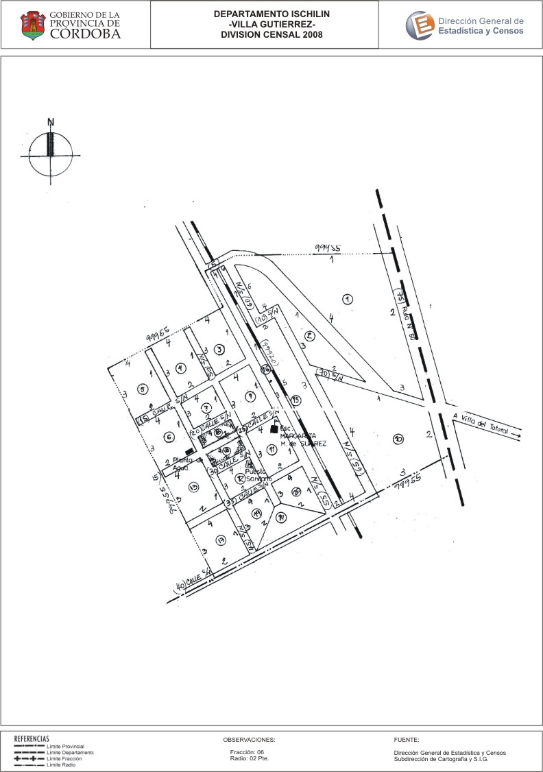
Mapa Villa Gutiérrez - División Censal - 2008
Dal riassunto del dataset
Encuentras aquí los mapas de los años 2008 y 2010 y las capas dl año 2010 de la cartografía base para tu localidad, en formatos shape, geojson, dbf, pdf y jpg - Las capas disponibles son...
Informazioni supplementari
| Campo | Valore |
|---|---|
| Ultimo aggiornamento | Luglio 7, 2017 |
| Creato | Luglio 7, 2017 |
| Formato | JPEG |
| Licenza | Creative Commons Attribution |
| created | più di 7 anni fa |
| format | JPEG |
| has views | True |
| id | 0600acbe-62fd-49ac-9c4e-0837fcbd1065 |
| last modified | più di 7 anni fa |
| on same domain | True |
| package id | 014b87e5-e04e-445a-98cc-18d65251c167 |
| position | 2 |
| revision id | 5faf702d-97e8-4d8c-ba48-d02d70781988 |
| state | active |
| url type | upload |