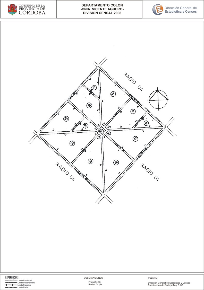
Mapa Colonia Vicente Agüero - División Censal ...
Aus der Zusammenfassung des Datensatzes
Encuentras aquí los mapas de los años 2008 y 2010 y la capa de ejidos del año 2010 de la cartografía base para tu localidad, en formatos shape, geojson, dbf, pdf y jpg.
Zusätzliche Informationen
| Feld | Wert |
|---|---|
| Zuletzt aktualisiert | 4. Juli 2017 |
| Erstellt | 4. Juli 2017 |
| Format | JPEG |
| Lizenz | Creative Commons Attribution |
| created | vor über 7 Jahren |
| format | JPEG |
| has views | True |
| id | c8b332a5-21db-4cbe-af36-05b0cc30f09e |
| last modified | vor über 7 Jahren |
| on same domain | True |
| package id | 1f011ac4-b170-4190-9bc3-263c3ba948d8 |
| position | 2 |
| revision id | a8f43127-c8f9-4d75-bea0-1fa7b27b709c |
| state | active |
| url type | upload |