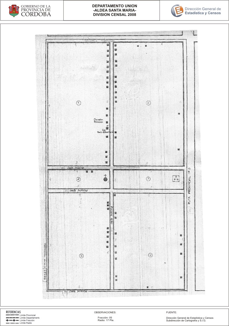
Mapa Aldea Santa María - División Censal - 2008
Dataset description:
Encuentras aquí los mapas de la cartografía base para tu localidad, pertenecientes a los años 2008 y 2010 en formatos pdf y jpg.
Source: Localidad Aldea Santa María - Mapas
Additional Information
| Field | Value |
|---|---|
| Data last updated | July 28, 2017 |
| Metadata last updated | June 16, 2026 |
| Created | July 28, 2017 |
| Format | JPEG |
| License | Creative Commons Attribution |
| Datastore active | False |
| Datastore contains all records of source file | False |
| Has views | True |
| Id | 616cf403-9258-4e0f-b433-69f2202d8d89 |
| Package id | dfad3b79-82d4-4a53-8665-c2d94b249f6e |
| Position | 2 |
| State | active |
| Tracking summary | {'total': 0, 'recent': 0} |
| Url type | upload |